
Walk a Pinellas County Street
Start a Pinellas County street directory search with the exact place, not a person's name. The Property Appraiser links a site address to a parcel, current owner, tax-mail address, legal description, and last deed. Those fields establish ownership and identify the land. They do not identify every occupant. A voter extract or an old reverse directory may add residents, while permits name people only in roles such as owner, applicant, or contractor.
- Enter the street number and name in the Property Appraiser Quick Search. Use fewer terms and standard suffix abbreviations if the first attempt fails.
- Open the parcel map and click the lots in order. Record each parcel number, site address, owner, and legal description.
- Use a lawfully obtained voter extract for registered voters by residence address. Expect protected addresses, nonvoters, and other household members to be absent.
- Carry the owner or book and page into the Clerk's Official Records index. Read the deed itself before treating a sales row as confirmed.
- For earlier occupants, consult address-first or criss-cross volumes and compare the entry with census, obituary, and deed evidence.
The flow is address to parcel, parcel to owner, owner to deed, then separate evidence for residency. This keeps a street-by-street search from turning an owner list into an unsupported household list.
Pinellas County Street Directory Fields
The Property Appraiser is the strongest current address index in Pinellas County. Its Quick Search can accept a partial street and return a whole segment. The office advises that less is more: start with the number and street name, abbreviate common suffixes, and try the documented local wording for roads such as Alternate U.S. 19 or Martin Luther King streets.
| Search control | Input | Useful result |
|---|---|---|
| Address | Partial or full street address | Parcel, owner, site address, legal and last deed |
| Owner | Person or entity name | Properties attached to that owner spelling |
| Parcel ID | Formatted county parcel number | One land record without street-name ambiguity |
| Sub/Condo | Subdivision or condominium | Units or lots within one named development |
| Book/Page | Official Records reference | Link from parcel data toward a Clerk document |
The result grid can be printed or exported. It includes parcel number, site address, property use, owner, subdivision or condominium, tax district, legal description, map, and last deed. The owner mailing address is where tax notices go. It can differ from the physical, or situs, address and does not prove where the owner lives.
The Pinellas parcel and address screen shows the entry point used for these by-address searches.
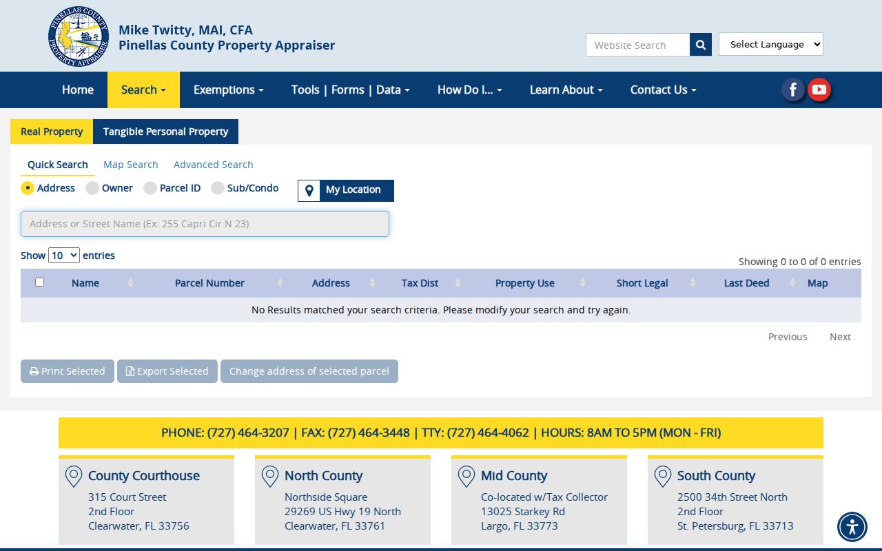
The captured screen helps readers recognize the official tabs before entering an address, owner, parcel, or subdivision.
Map Pinellas County Street Parcels
The Property Appraiser GIS viewer turns one parcel into an ordered walk along the block. Search by owner, address, or parcel ID, then click each outlined neighboring parcel. The selection changes to that lot's detail. Controls include aerial and filled or unfilled parcel styles, sales overlays, measurement, printing, and a countywide plan view.
The map is an index and browsing aid, not a land survey or title opinion. Lines can help select the next parcel, but the parcel card and recorded deed supply the stronger identity trail. County GIS services also provide boundaries, elections, flood, planning, infrastructure, transportation, and public-safety layers.
The official interactive parcel map illustrates the adjacent-parcel method.
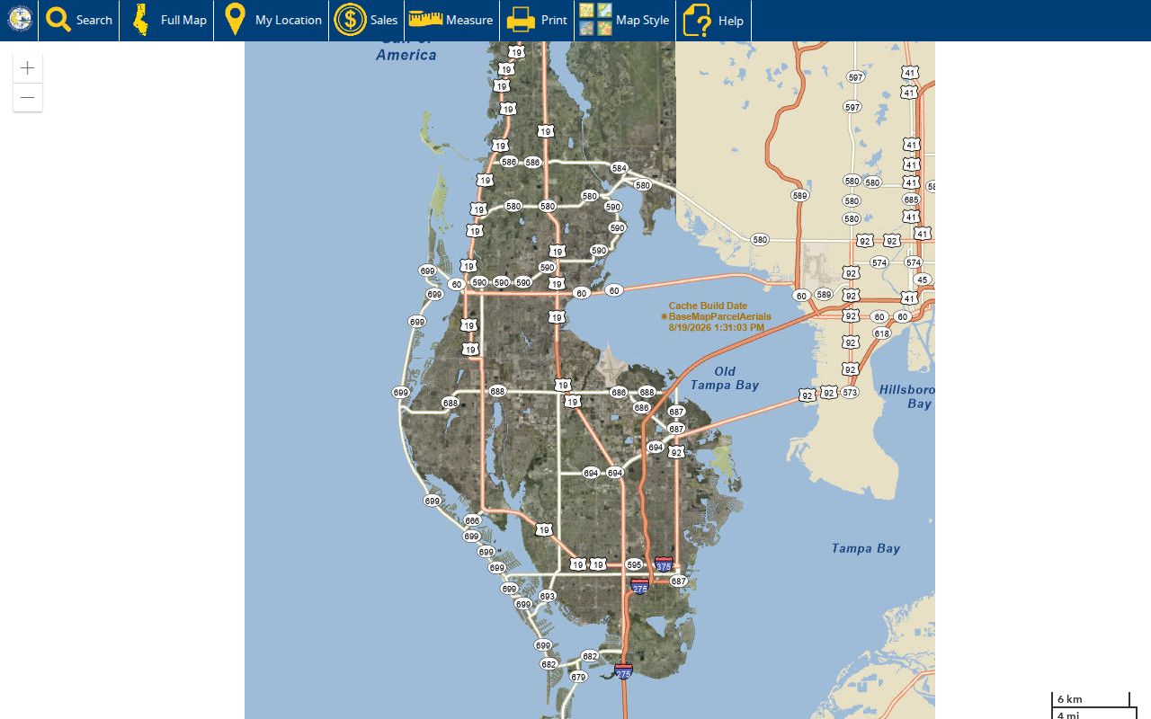
Each click shifts the parcel detail, so a researcher can build a careful lot-by-lot list without assuming the map itself names occupants.
The county's maps and GIS catalog provides the wider set of boundary and service layers.
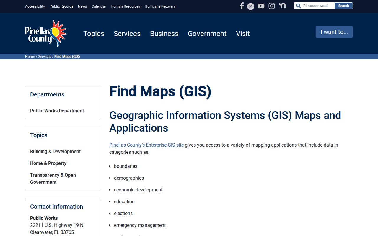
Those extra layers help explain why parcels on one postal street can fall under different service or planning authorities.
Pinellas County Street Record Terms
Four terms prevent common errors in a street directory search. Pinellas County systems use them for different parts of the same address trail.
- Parcel
- A mapped unit of land with its own county identifier.
- Situs address
- The physical location assigned to the parcel, unlike the owner's tax-mail address.
- Plat
- A recorded map that identifies subdivisions, blocks, lots, and related book and page references.
- Criss-cross directory
- An address-first printed directory that leads from a street and number to a listed occupant.
A parcel number and legal description often survive a changed postal label. They are safer bridge keys when an old address no longer matches a modern search box.
Pinellas County By-Address Records
Each public source answers a narrow question. A complete Pinellas County street directory search preserves those roles instead of merging all names into one resident list. The following channels include online tools and the counter or request routes needed when a portal is incomplete.
| Record Set | Keeper | What It Shows | Access |
|---|---|---|---|
| Property roll | Property Appraiser | Owner, site and mail addresses, parcel, exemptions | Free portal, export, or four office counters |
| Parcel GIS | Property Appraiser and county eGIS | Adjacent lots, boundaries, map layers | Free viewer and GIS catalog |
| Deeds and liens | Clerk Recording Services | Indexed parties, legal description, instruments | Online from 1957; earlier books at Clerk rooms |
| Voter information | Supervisor of Elections and Florida Division of Elections | Public registration fields, subject to exemptions | Self-check, extract request, email, phone, or office |
| Permits and code | County BDRS or serving municipality | Project, status, applicants, inspections | Access Portal, records desk, or city system |
The parcel number ties the tax roll to maps, plats, permits, and deeds. Street text is less stable. Florida voter information is generally public, but the self-service status tool is for a voter checking a record, not browsing a street. A public extract can be requested from the state or through Pinellas elections IT and filtered by residence fields where supplied.
Pinellas County Street Deed Records
An assessor sales row is a lead, not the deed. Open the current parcel's last deed in the Clerk Official Records Search and compare the grantee, grantor, instrument number, dates, and legal description. The online index covers 1957 forward and offers name, instrument, document type, record date, consideration, book/page, case number, and legal-description searches.
For an older chain, visit the Official Records room at 315 Court Street in Clearwater or the downtown St. Petersburg branch and work through manual deed-book and grantor/grantee indexes. Records created before Pinellas County began in 1912 may remain under Hillsborough County. Images that fail as PDF may open through the portal's TIFF option.
Note: Property Appraiser ownership links can lag recording by four to six weeks, so confirm a recent transfer in the Clerk's index.
Pinellas County Street Permit Records
The county Access Portal accepts street-number ranges, direction, street name, type, unit, parcel digits, record number, project, dates, and applicant fields. The default date range is only the past two years, so widen it for older work. No account is needed to search. Results show a record number, status, information, reviews, and inspections.
The portal does not cover every Pinellas County address. County BDRS serves unincorporated land and certain partner towns. Other incorporated cities keep their own systems, and Belleair Bluffs moved new permits to SAFEbuilt in 2025. Use the parcel jurisdiction first, then contact the correct city or the county records desk by phone, email, or in person for missing material.
The permit and code address search displays the controls used to narrow a record by street.
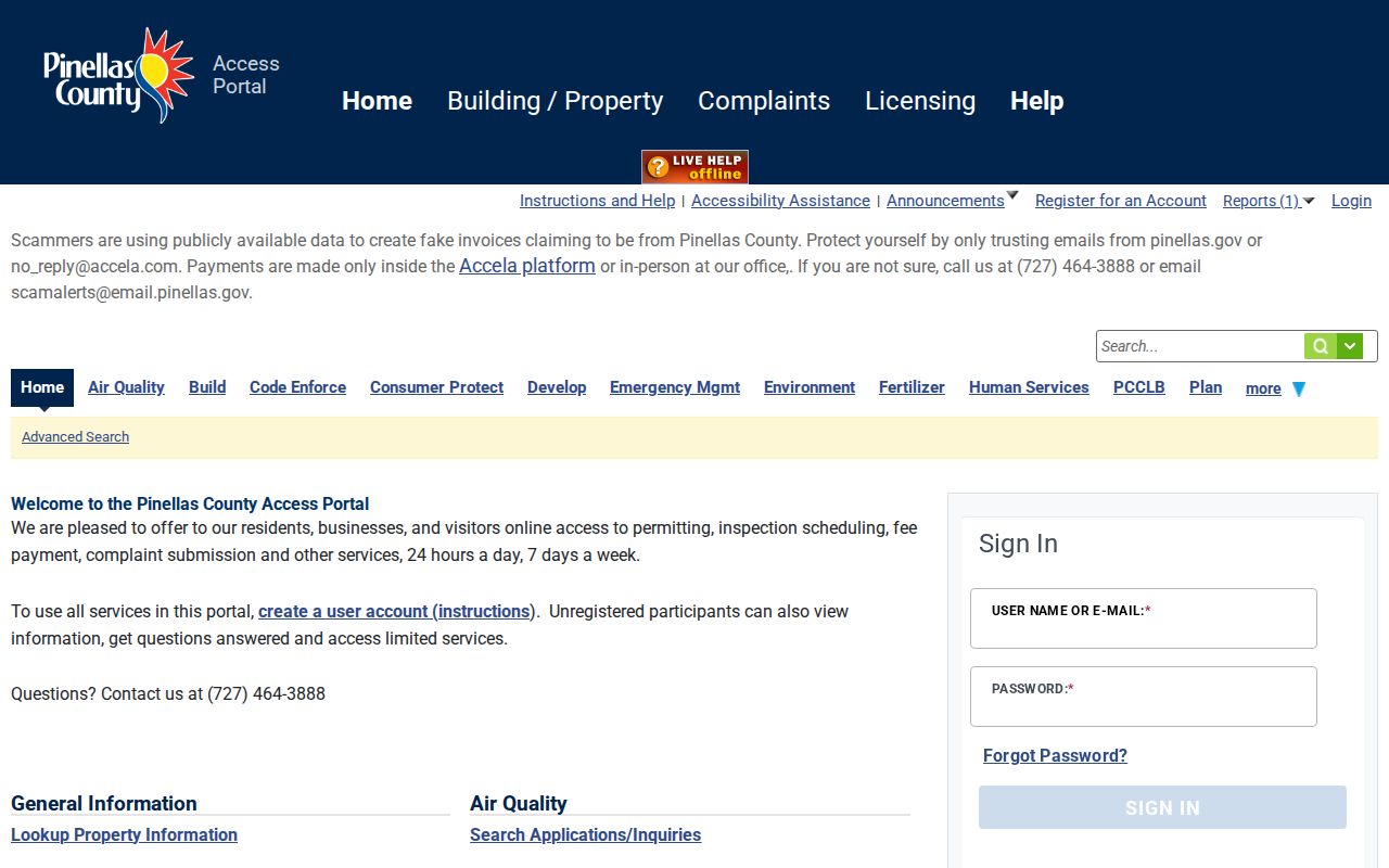
The image also reinforces why dates and jurisdiction must be checked before a no-result is treated as no record.
For unincorporated code concerns, the county also publishes an address-based code complaint route.
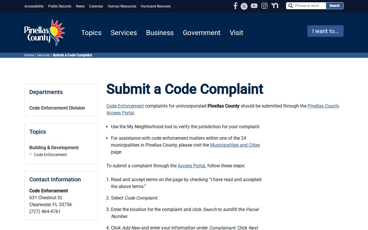
The form is a reporting channel, not proof of who lives at the address, and any resulting case should be read by record number and status.
Pinellas County Street Jurisdictions
Pinellas County contains 24 municipalities plus unincorporated communities and enclaves. A Clearwater, Largo, St. Petersburg, or beach-community mailing label may cross a city boundary. ZIP codes route mail; they do not assign permit, code, police, or planning custody. The parcel summary's jurisdiction field is the practical first check.
Enter street address, city, and ZIP in the county's My Neighborhood jurisdiction lookup. The result routes local services and helps identify whether a county or city office should hold a case. If a historic street seems to vanish, compare the parcel number, legal description, plat, old directory abbreviations, and maps. No official countywide street-renaming concordance was found.
The address jurisdiction form shows the three-part input used to resolve the serving government.
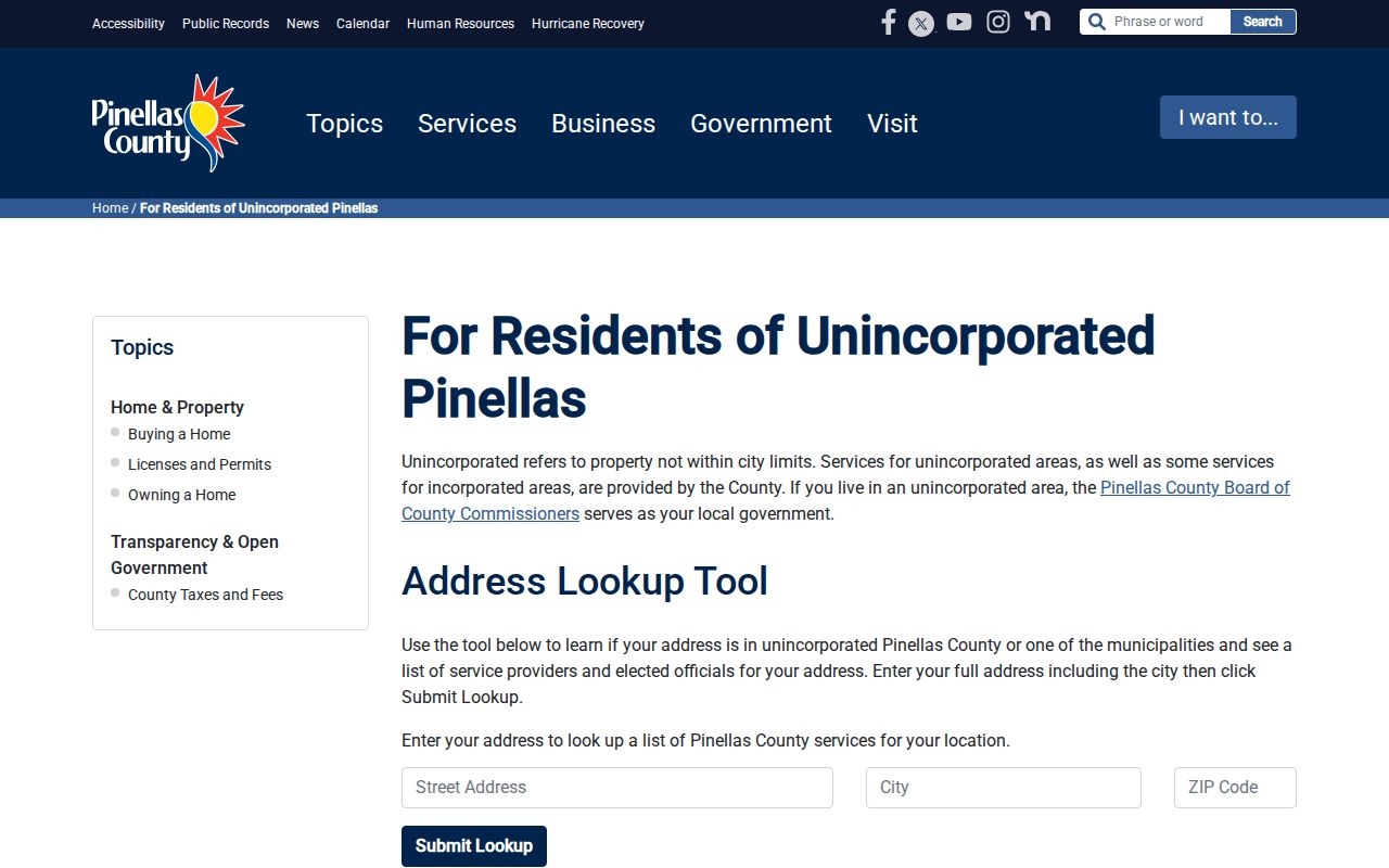
That jurisdiction result is the bridge from a postal address to the office that actually keeps local permits and code files.
Historic Pinellas County Street Directories
Reverse directories turn an old address into a listed occupant between census years. Publication lag, abbreviations, missing years, and later renumbering require cross-checks. The Pinellas Genealogy Society has local directory and census material for 1900, 1908, 1912, 1914, 1918, and an index through 1920. Those early headings may reflect Hillsborough-era geography.
Use the historical volumes as an address bridge, then move to census schedules, deeds, obituaries, and probate. The Pinellas County directory book collections are covered separately so the street directory can stay focused on address use.
Pinellas County Street Directory Limits
No public street directory reliably supplies every renter, child, roommate, utility customer, or other household member. The property roll names owners. Permits name people tied to work. Voter data omits nonvoters and protected records. Motor-vehicle personal data remains controlled by federal law, and a missing voter or address result must never be used to infer protected status.
Homestead exemption can support an owner-occupancy hypothesis, but trusts, filing dates, exemptions, redactions, and timing gaps prevent it from proving who lives there. Commercial neighbor tools often repackage old public and purchased data. Official records are still role-specific and must be dated and compared.
Lawful use. Use Pinellas County address records for lawful personal research. Public availability never permits stalking, threats, impersonation, harassment, or harm.